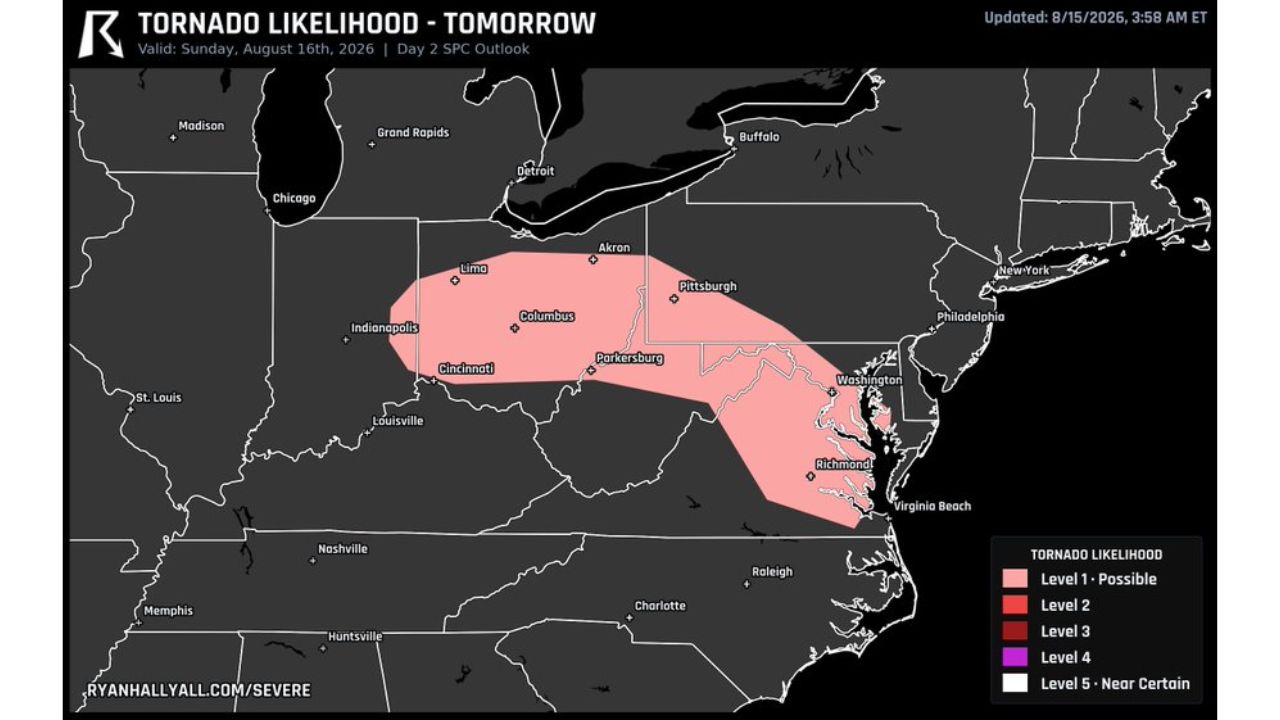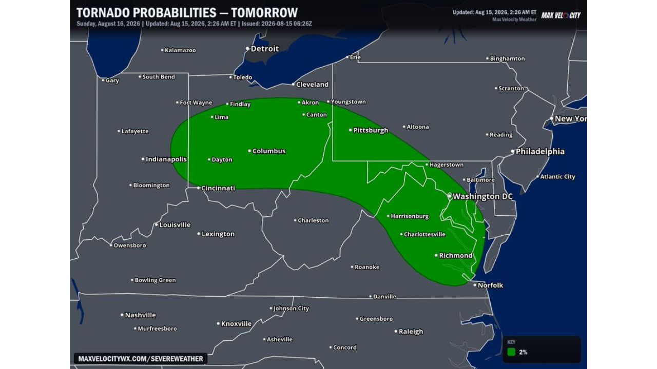
COLUMBUS, Ohio — Sunday’s tornado threat expanded significantly overnight, growing from a corridor centered on Indiana and Ohio into a much longer zone stretching all the way into the Mid-Atlantic. The 2 percent tornado probability zone now runs from Fort Wayne and Indianapolis through Columbus, Pittsburgh, Washington, D.C., Charlottesville and down to Richmond and Norfolk, putting a much wider stretch of cities at risk for a brief spin-up tornado Sunday.
What the Expanded Outlook Shows
- Tornado probability: 2 percent
- Valid: Sunday, Aug. 16, 2026
- Updated: 2:26 a.m. ET, Aug. 15, 2026
- Western edge: Lafayette, Fort Wayne, Indianapolis
- Central corridor: Lima, Findlay, Columbus, Dayton, Cincinnati
- Northeastern extension: Akron, Canton, Pittsburgh
- New Mid-Atlantic reach: Hagerstown, Washington, D.C., Harrisonburg, Charlottesville, Richmond, Norfolk
Why the Overnight Expansion Matters
What changed between forecast updates isn’t the intensity of Sunday’s tornado threat, it’s the reach. The same low-end, brief spin-up risk that had been confined to Indiana and Ohio now stretches roughly 400 miles further east, pulling major Mid-Atlantic cities like Washington, D.C. and Richmond into the same probability zone as Columbus and Pittsburgh. That kind of overnight growth in a Day 2 outlook signals forecasters are seeing the ingredients for tornado-capable storms extend further along the same boundary or airmass than initially expected, even though the probability itself remains at the lower end of the scale.
What to Watch For as Sunday Approaches
As of this writing, this remains a Day 2 tornado probability outlook, not a confirmed watch or warning. No severe thunderstorm or tornado watches tied to this expanded zone have been issued yet. Because the threat has already grown once overnight, this article will be updated if the zone shifts further before Sunday arrives.
A Threat That Keeps Growing Its Footprint
Sunday’s tornado risk illustrates how quickly a modest, low-probability outlook can widen its geographic reach as forecasters refine the setup closer to the event. With the zone now stretching from central Indiana to coastal Virginia, residents across a much broader swath of the Ohio Valley and Mid-Atlantic, including Columbus, Pittsburgh and the nation’s capital, are being encouraged to watch for updates as Sunday’s severe weather picture continues to take shape.
For more coverage like this, check back for the latest severe weather updates.