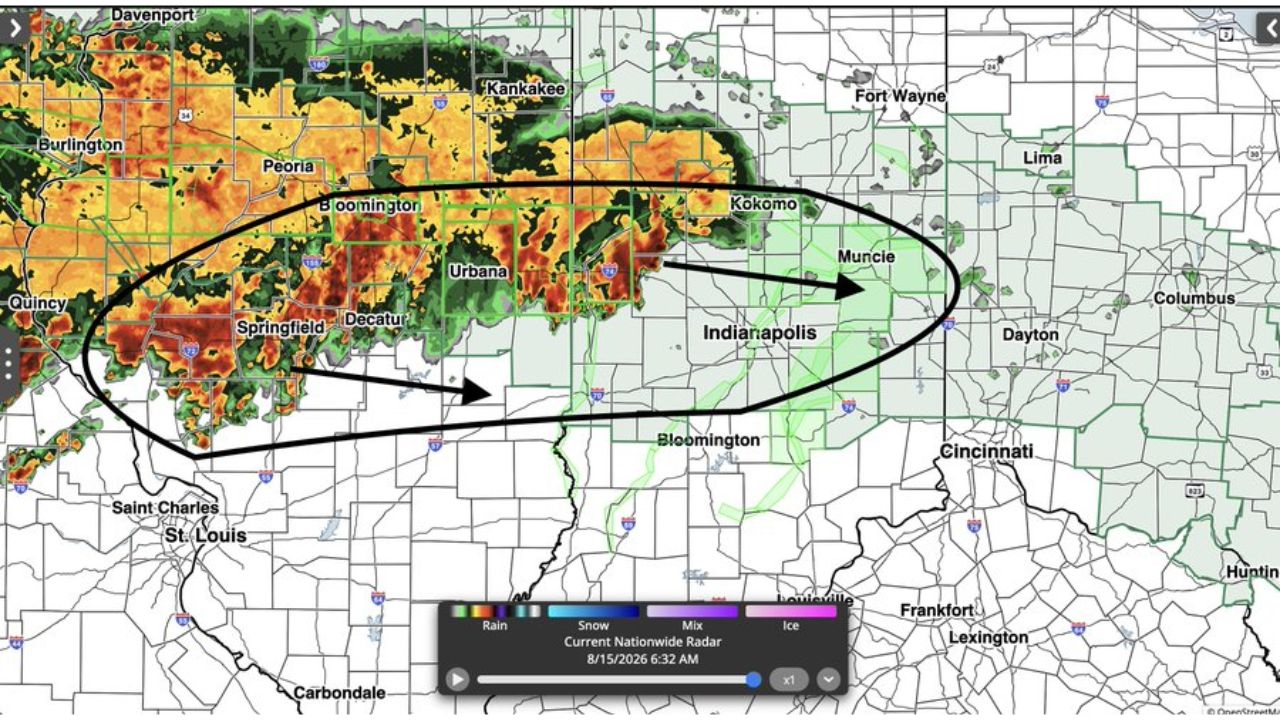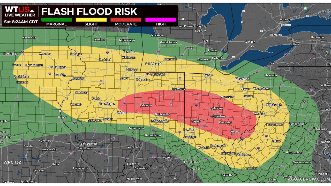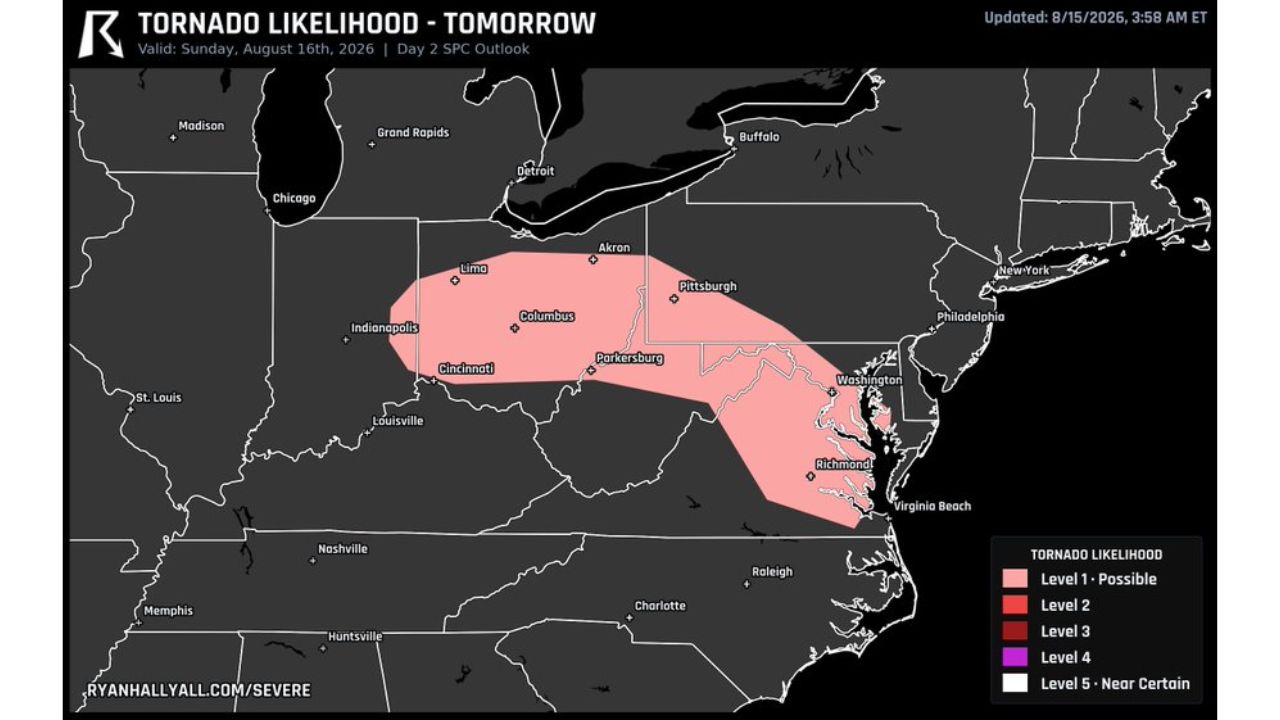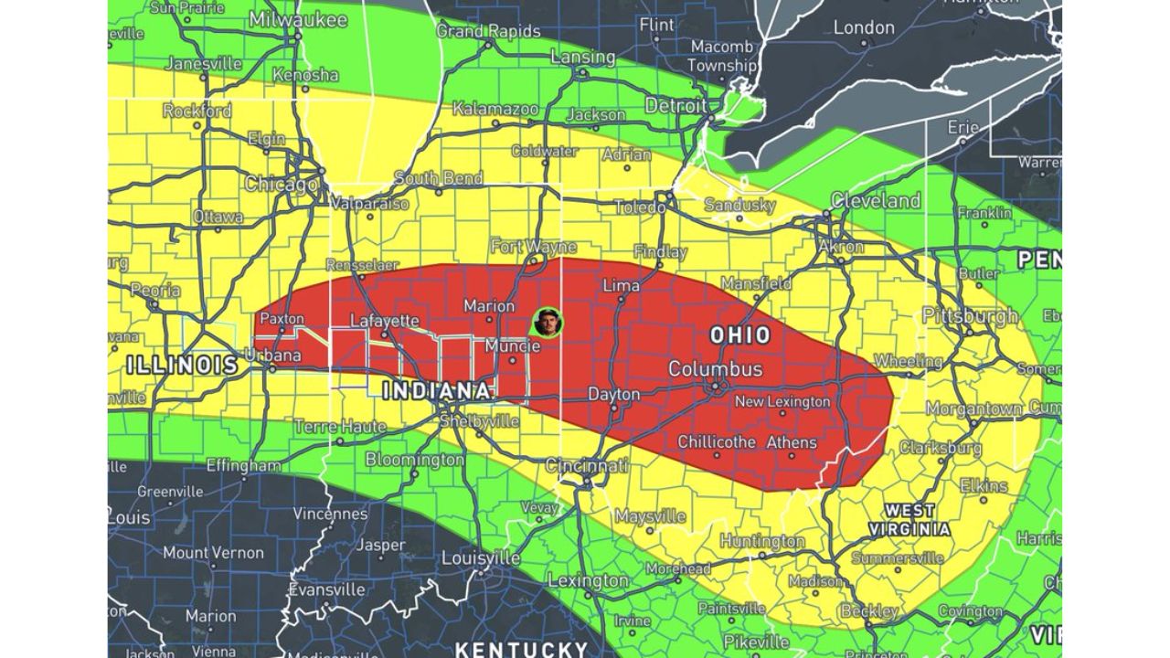
DAYTON, Ohio — The flooding threat across eastern Illinois, central Indiana and Ohio escalated Saturday afternoon as forecasters confirmed flash flooding is already ongoing across the region, with any additional rain now capable of triggering more significant flooding. A Moderate Risk of excessive rainfall covers a corridor from Lafayette and Muncie through Dayton, Columbus, Chillicothe and Athens, while meteorologists tracking the storms also flagged a conditional tornado risk developing alongside the flood threat this afternoon.
What Today’s Update Shows
- Alert type: Moderate Risk of excessive rainfall, plus a conditional tornado risk
- Highest-risk corridor: Lafayette, Muncie, Dayton, Columbus, New Lexington, Chillicothe, Athens
- Surrounding Slight Risk zone: Chicago, South Bend, Fort Wayne, Cincinnati, Cleveland, Pittsburgh
- Ground condition: flash flooding already ongoing across the region
- Compounding risk: any additional precipitation could worsen flooding today
- Additional hazard: conditional tornado risk this afternoon, being tracked alongside the flood threat
Why “Already Ongoing” Changes the Picture
Unlike a forecast that warns flooding could develop, today’s update confirms flooding is already happening across parts of the region, shifting the danger from a future risk to a present, worsening one. That distinction matters because it means the ground and waterways in the Moderate Risk zone have little to no capacity left to absorb more rain, so even scattered additional storms this afternoon could push already-flooded areas into more serious territory. Layering a conditional tornado risk on top of active flooding adds a second hazard residents need to track at the same time, one tied to storm mode and atmospheric setup rather than saturated ground.
What to Watch For This Afternoon
As of this writing, flooding is confirmed ongoing, and the tornado risk remains conditional, meaning it depends on how storms organize through the afternoon. No specific flash flood warnings or tornado watches tied to this update have been confirmed. This article will be updated as warnings are issued or confirmed impacts are reported.
Two Hazards, One Fast-Moving Afternoon
Saturday’s combination of ongoing flooding and a fresh conditional tornado risk marks an escalation for a corridor that has already absorbed repeated rounds of heavy rain this week. With Lafayette, Muncie, Dayton and Columbus sitting inside the highest-risk zone for both hazards, residents across the region are being urged to stay alert to fast-changing conditions rather than treating this as a routine flood advisory.
For more coverage like this, check back for the latest severe weather updates.