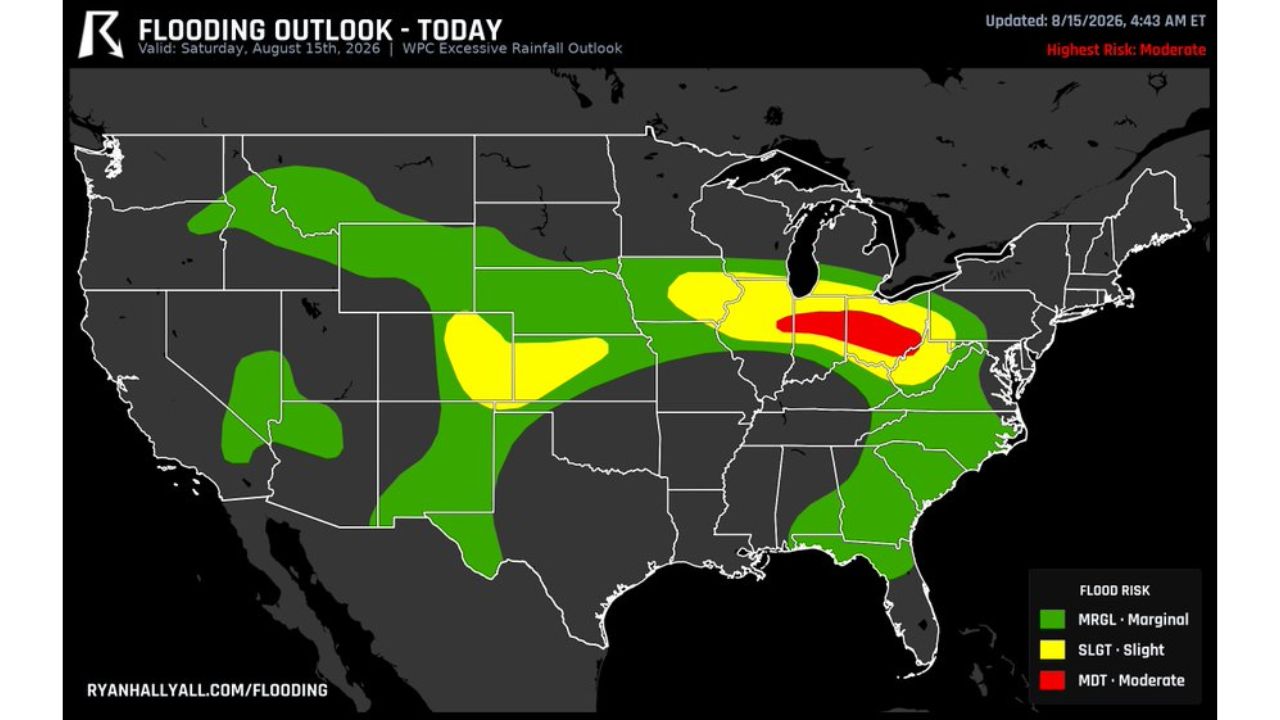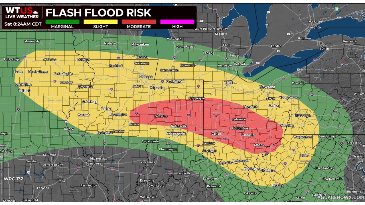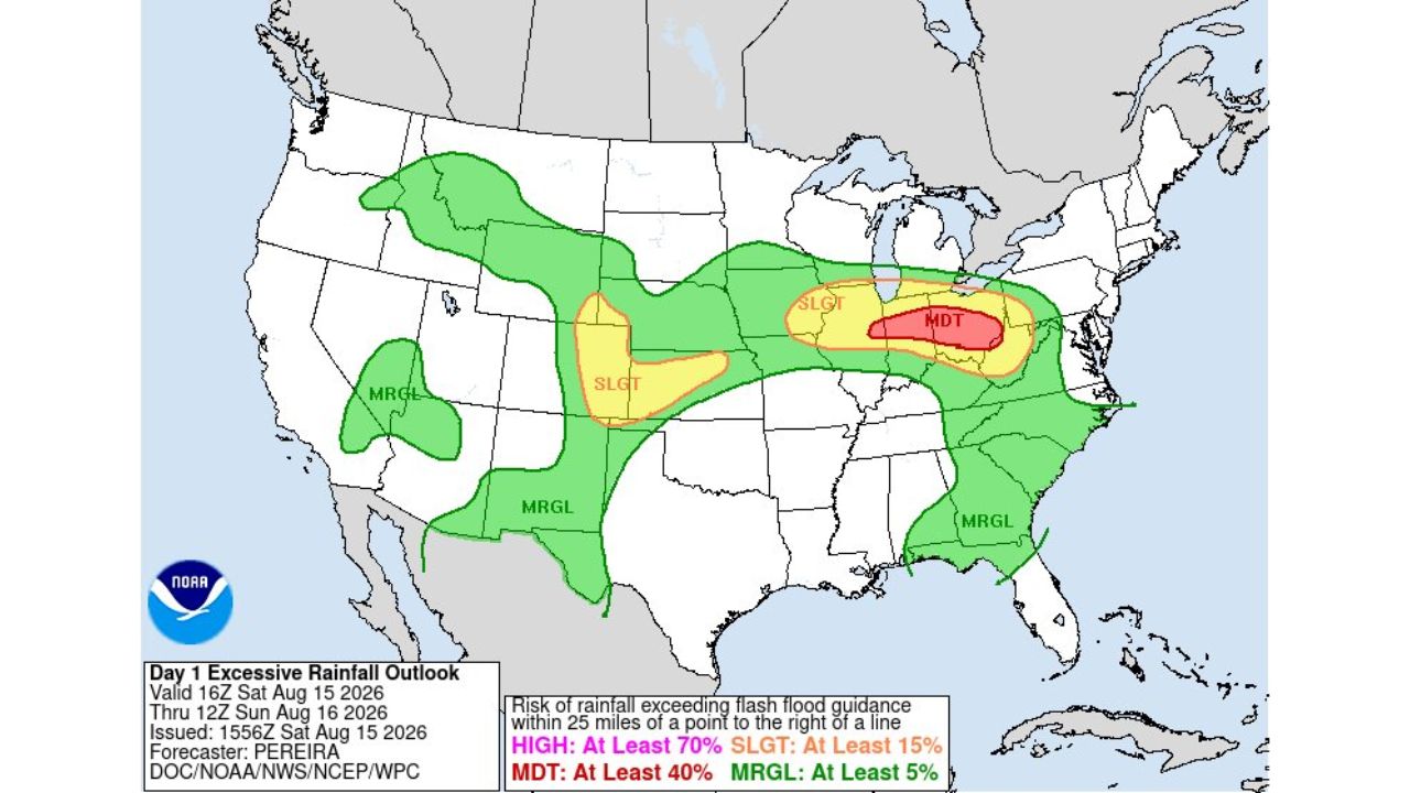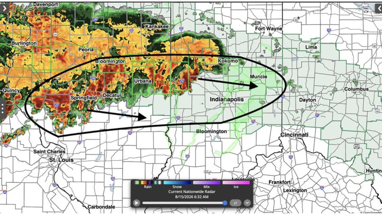
KOKOMO, Ind. — An extremely concerning training rain setup developed early Saturday morning across a corridor stretching from Peoria and Springfield, Illinois through Kokomo, Muncie and Indianapolis, Indiana, with rainfall rates capable of exceeding 1 inch per hour and localized spots potentially seeing an additional 3 inches or more. Forecasters warned the situation is especially dangerous for parts of Indiana already dealing with ongoing flooding and dramatically high river levels.
What the Radar Setup Covered
| Category | Forecast Detail |
|---|---|
| Conditions | Training rain and storms, high rainfall rates |
| Rainfall rate | Can exceed 1 inch per hour |
| Localized additional totals | 3 inches or more possible in some spots |
| Storm track | West to east, from near Peoria and Springfield, Ill. through Kokomo, Muncie and Indianapolis, Ind. |
| Compounding factor | Parts of Indiana already experiencing ongoing flooding with dramatically high river levels |
| Radar time | 6:32 a.m., Aug. 15, 2026 |
Why High River Levels Change Everything Here
What makes this setup especially dangerous, in forecasters’ own words, is that the new round of training storms is arriving on top of Indiana rivers already running at dramatically high levels from ongoing flooding. Unlike a fresh rain event hitting normal river conditions, additional 3-plus inch localized totals falling into rivers that have little room left to rise can push waterways over their banks far faster than the rainfall alone would suggest. That combination is why this event was described as a very dangerous situation, particularly for anyone living in flood-prone areas along rivers in the path of the training storms.
What to Watch For as Rivers Continue to Run High
As of this writing, this remains an active, developing situation with training storms ongoing as of early Saturday morning. No confirmed damage, evacuation, or injury reports specific to this rainfall event have been published. This article will be updated as river levels, flood warnings, or confirmed impacts are reported.
Safety Guide: What to Do When New Rain Hits Already-High Rivers
If you live near a river in the path of these storms:
- Monitor river levels closely, since already-high rivers can crest faster with new rainfall
- Have an evacuation plan ready if you’re in a flood-prone area near a river
- Move vehicles and valuables to higher ground now, before water rises further
- Charge phones and battery packs in case flooding disrupts power
As training storms continue overhead:
- Never drive through flooded roads: turn around, don’t drown
- Avoid low-lying areas and creek crossings entirely until the rain moves out
- Stay alert overnight and into the morning, since training storms can persist for hours**
After this round passes:
- Don’t assume river levels will drop quickly: cresting can lag well behind the heaviest rain
- Watch for continued flooding in areas already affected before this new rain arrived
- Check on neighbors near rivers, especially in flood-prone communities around Kokomo and Muncie
Indiana’s Rivers Have No Room Left to Rise
Saturday’s training rain event lands on an Indiana landscape already strained by flooding and swollen rivers, turning what would normally be a heavy rain forecast into a genuinely dangerous scenario for flood-prone communities. With localized totals topping 3 inches possible on top of already-high water, forecasters are urging residents near rivers in the Kokomo-to-Muncie corridor to treat this as an immediate, serious threat rather than routine summer rain.
For more coverage like this, check back for the latest severe weather updates.