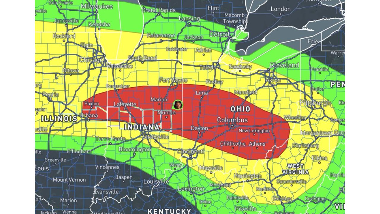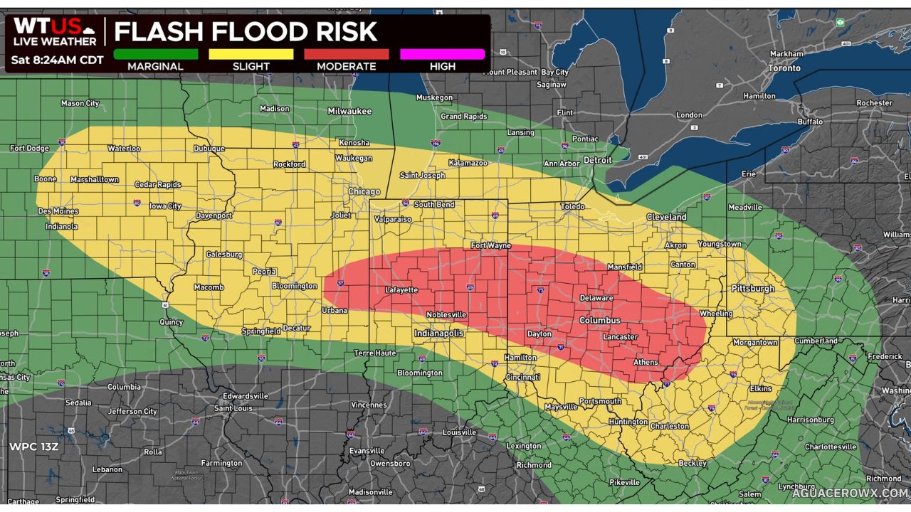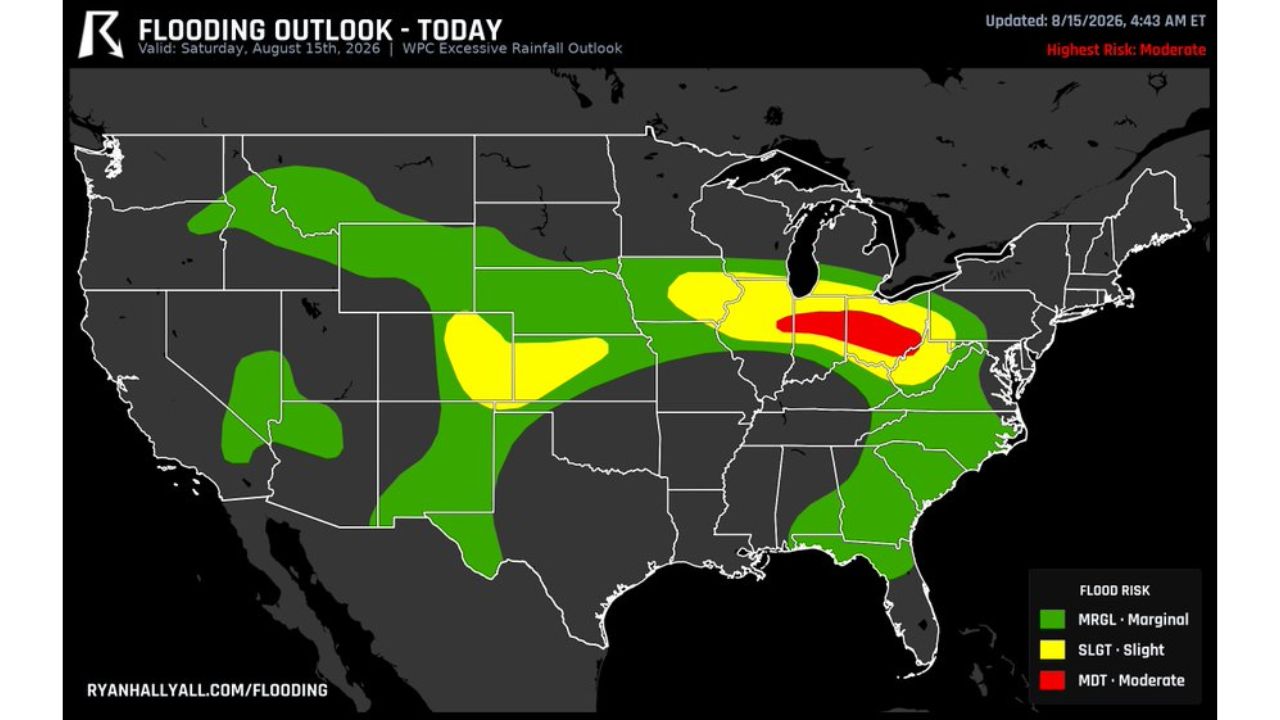
COLUMBUS, Ohio — The Weather Prediction Center’s (WPC) Moderate Risk flooding zone spread west into Illinois Saturday, joining an already-active area over Ohio and Indiana, putting roughly six million people from Columbus and Dayton to Lafayette and Kokomo in line for more heavy, repeating storms capable of pushing water over roads quickly.
What the Excessive Rainfall Outlook Covered
| Category | Forecast Detail |
|---|---|
| Product | WPC Excessive Rainfall Outlook |
| Valid | Saturday, Aug. 15, 2026 |
| Updated | 4:43 a.m. ET, Aug. 15, 2026 |
| Highest risk level | Moderate (MDT) |
| Moderate Risk area | Spread west into Illinois, now joining Ohio and Indiana |
| Population in Moderate zone | Roughly six million people |
| Cities in Moderate zone | Columbus, Dayton, Lafayette, Kokomo |
| Slight Risk (SLGT) zone | Broader band across Illinois, Indiana, Ohio, plus parts of the central Plains and Rockies |
| Marginal Risk (MRGL) zone | Widest band, stretching from the Pacific Northwest through the Southeast |
Why a Widening Risk Zone Matters More Than a New One
Saturday’s outlook isn’t describing a fresh flooding threat, it’s the same setup expanding its footprint. The Moderate Risk area that had been concentrated over Ohio and Indiana grew to include Illinois, meaning the population facing the highest flooding probability jumped to roughly six million people across a wider three-state stretch. Because the storms driving this risk are described as repeating, training over the same areas rather than passing through once, the danger isn’t just rainfall totals on a map, it’s roads and low-lying areas seeing water rise fast, sometimes before drivers have time to reroute.
What to Watch For as the Wider Zone Takes Shape
As of this writing, the Moderate Risk zone reflects Saturday’s updated, wider footprint across Illinois, Indiana and Ohio. No confirmed flooding, damage, or rescue reports specific to this expanded outlook have been published. This article will be updated as watches, warnings, or confirmed flooding reports become available.
Safety Guide: What to Do When Flood Risk Spreads to a New State
Before repeating storms arrive:
- Check if your area is newly included in the Moderate Risk zone, especially in Illinois, where the risk just expanded
- Know your fastest alternate routes in case flooded roads block your usual path
- Charge phones and battery packs: repeating storms can cause extended outages
- Avoid parking near low-lying roads or creek crossings given how fast water can rise
If you hit high water while driving:
- Turn around immediately: don’t push through, even if the water looks shallow
- Find an alternate route rather than waiting to see if the water recedes
- Report flooded roads to local authorities if it’s safe to do so
After this round of storms passes:
- Don’t assume the risk has passed if repeating storms are still forecast for your area
- Watch for flash flooding on familiar roads, since fast-rising water can catch even longtime residents off guard
- Check on neighbors, especially in newly added risk areas that may be less prepared
A Flood Risk That Keeps Growing Its Reach
Saturday’s expanded Moderate Risk zone shows how a single flooding setup can widen its impact day by day, pulling in millions more people as it stretches from Ohio and Indiana into Illinois. With repeating storms expected to keep pushing water over roads across the Columbus-to-Lafayette corridor, residents throughout the newly expanded zone are being urged to treat fast-rising water as a real and immediate risk rather than a distant possibility.
For more coverage like this, check back for the latest severe weather updates.