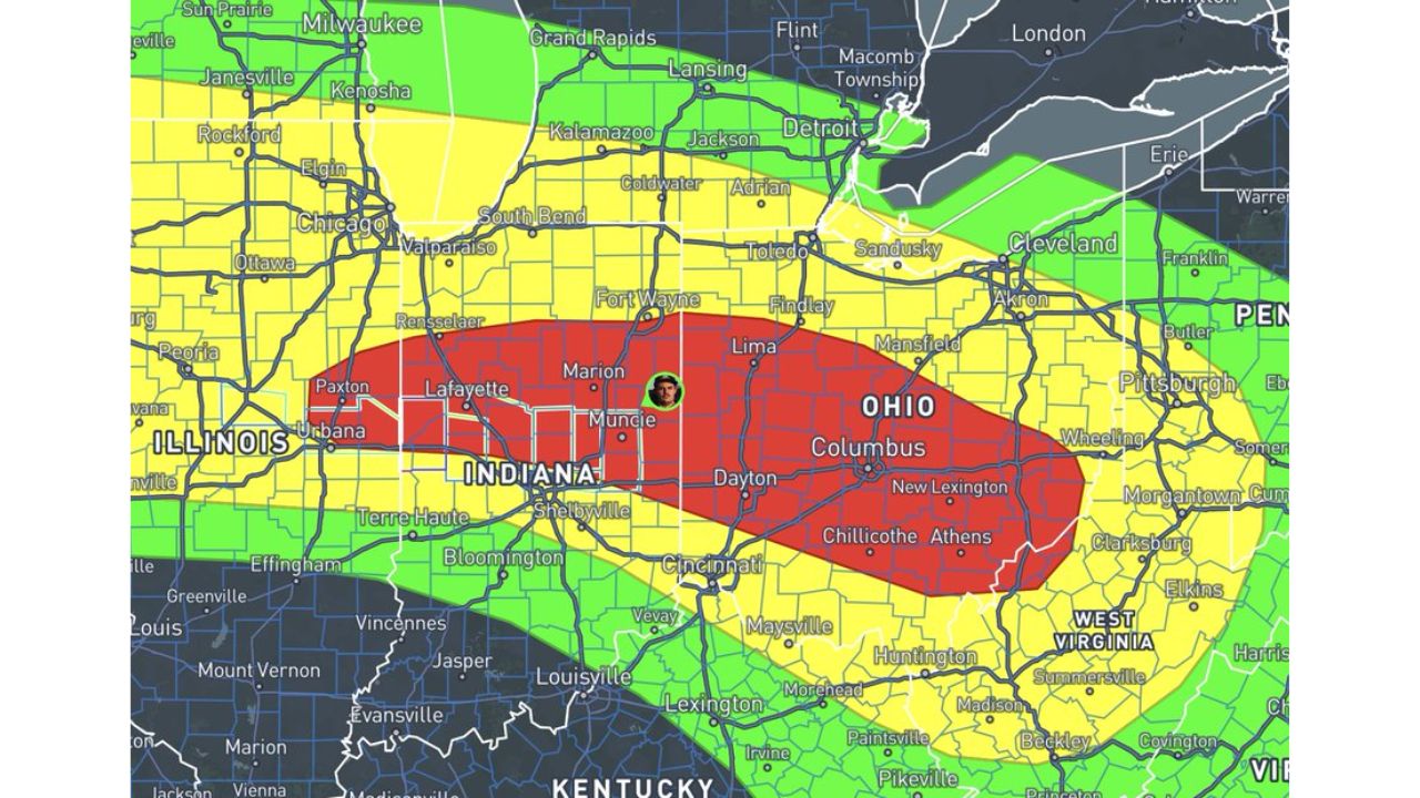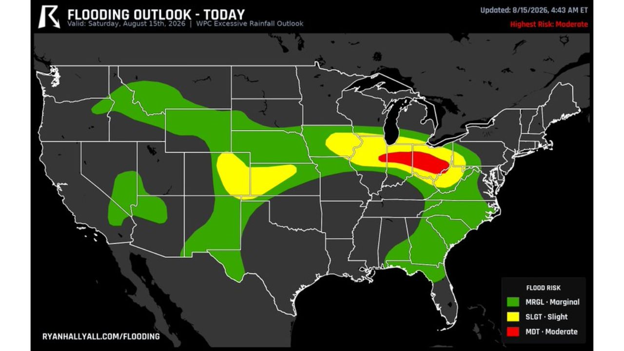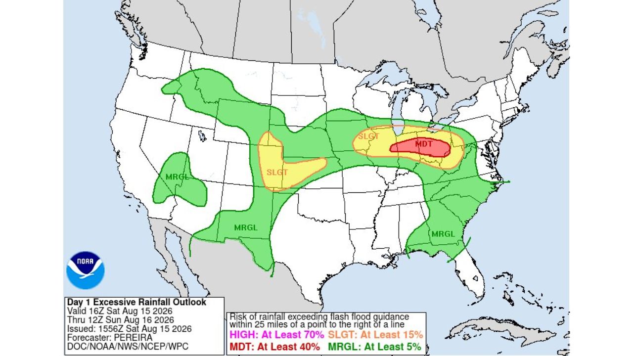
COLUMBUS, Ohio — The Weather Prediction Center made it official Saturday afternoon: a Moderate Risk is in effect for excessive rainfall across the Ohio Valley, running from 16Z Saturday, Aug. 15 through 12Z Sunday, Aug. 16, 2026. The designation, issued at 1556Z by forecaster Pereira, confirms the same corridor flagged earlier in the day, a band roughly centered on Columbus and stretching toward western Ohio and northeastern Indiana, now carries at least a 40 percent chance of rainfall exceeding flash flood guidance within 25 miles of any point in the zone.
What the Day 1 Excessive Rainfall Outlook Shows
- Highest risk (Moderate): at least 40 percent chance, centered on Columbus and stretching toward western Ohio and northeastern Indiana
- Slight Risk: at least 15 percent chance, wraps around the Moderate zone from the Dakotas through the Great Lakes and down into the mid-Atlantic
- Marginal Risk: at least 5 percent chance, stretches even further into the Pacific Northwest, the Great Basin, the southern Plains and the Southeast
- Valid window: 16Z Saturday, Aug. 15 through 12Z Sunday, Aug. 16, 2026
- Issued: 1556Z, Aug. 15, 2026
- Forecaster: Pereira, WPC
Why the 40 Percent Threshold Matters
What makes the official Moderate designation notable is the confidence behind it. The Weather Prediction Center reserves that tier for setups where forecasters see a real, elevated chance that rain will fall faster than the ground and drainage systems in the corridor can handle, not just a generic heavy rain forecast. For a region already dealing with saturated soils from repeated storms this week, that 40 percent threshold matters more than it would on drier ground.
What to Watch For Through Sunday Morning
As of this writing, no flash flood warnings tied to this outlook have been issued. The Moderate Risk window runs through Sunday morning, meaning the highest-confidence threat is concentrated in the overnight hours. This article will be updated as warnings are issued or confirmed flooding is reported across the Ohio Valley.
A Region Already on Edge
Saturday’s official confirmation lands on an Ohio Valley that has spent much of the week absorbing repeated rounds of heavy rain, leaving little buffer for a fresh 40 percent flash flood risk to take hold. With the overnight hours carrying the highest confidence for flooding, residents across Columbus, western Ohio and northeastern Indiana are being urged to treat this as an active, developing threat rather than a routine forecast update.
For more coverage like this, check back for the latest severe weather updates.