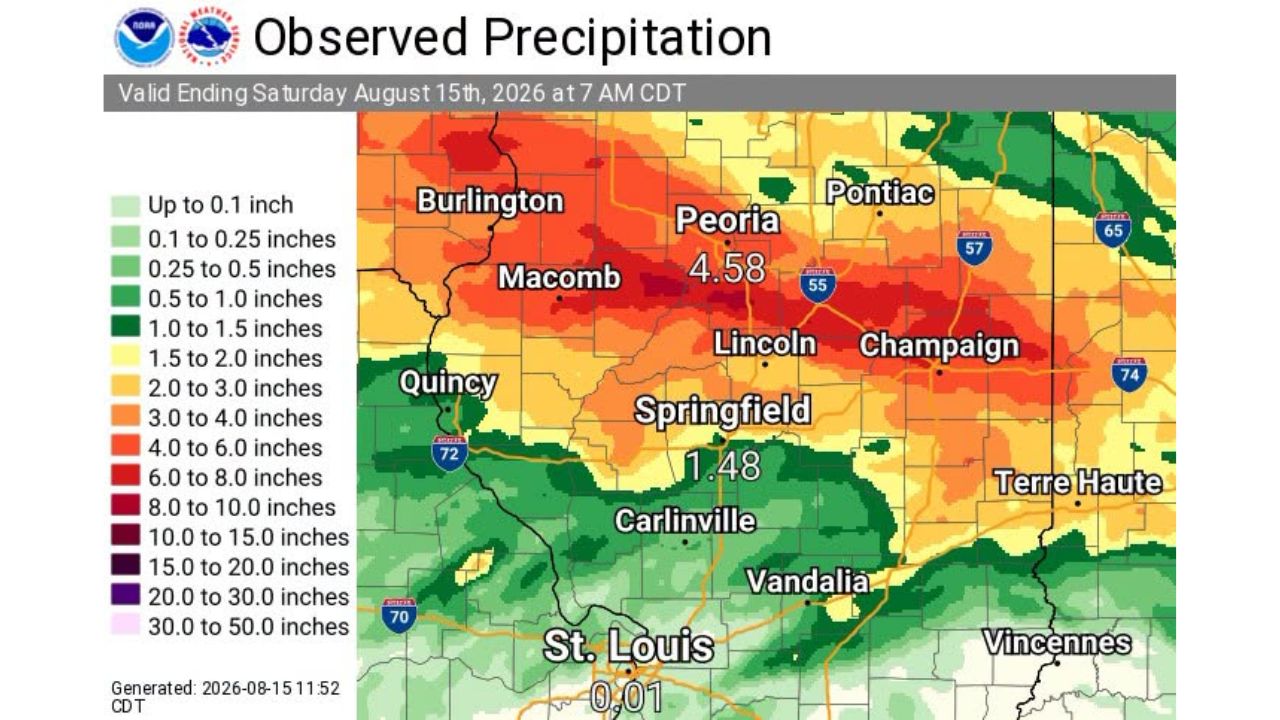
CANTON, Ill. — A 48-hour deluge left parts of central Illinois underwater ahead of Saturday morning, with Canton recording 9.91 inches of rain, one of the highest totals in a corridor stretching from Fulton County through McLean and into Vermilion County. Nearby, a site 3 miles northwest of Hopedale measured 9.42 inches, while a location 4 miles east-southeast of Bloomington picked up 8.46 inches, all in the 48 hours ending at 7 a.m. CDT Saturday, Aug. 15, 2026.
What the 48-Hour Rainfall Map Shows
- Measurement window: 48 hours, ending 7 a.m. CDT, Saturday, Aug. 15, 2026
- Heaviest-hit corridor: Fulton County through McLean County into Vermilion County
- Highest reported total: 9.91 inches, Canton, Illinois
- Second-highest total: 9.42 inches, 3 miles northwest of Hopedale
- Third-highest total: 8.46 inches, 4 miles east-southeast of Bloomington
- Peoria area: 4.58 inches
- Springfield area: 1.48 inches
- St. Louis area: 0.01 inches, showing the sharp cutoff south of the heaviest band
Why the Rainfall Gradient Matters
The map shows just how narrow and intense this rain band was: Canton and Peoria, roughly 30 miles apart, saw totals more than double one another, and just further south, Springfield measured barely over an inch while St. Louis picked up almost nothing at all. That kind of sharp drop-off, from nearly 10 inches to essentially none within about 100 miles, reflects how a slow-moving or repeatedly training storm system can dump extreme totals on one specific corridor while leaving nearby areas largely untouched, a pattern consistent with the kind of flash flooding risk that has plagued the region in recent days.
What Happened as the Rain Totals Were Compiled
As of this writing, these are observed, confirmed rainfall totals from the 48-hour period ending Saturday morning, not a forecast. No specific flooding damage, evacuation, or injury reports tied to these totals in Fulton, McLean or Vermilion counties have been published in the data provided. This article will be updated if confirmed flooding, damage, or impact reports become available.
A Band of Extreme Totals in a Week Already Defined by Rain
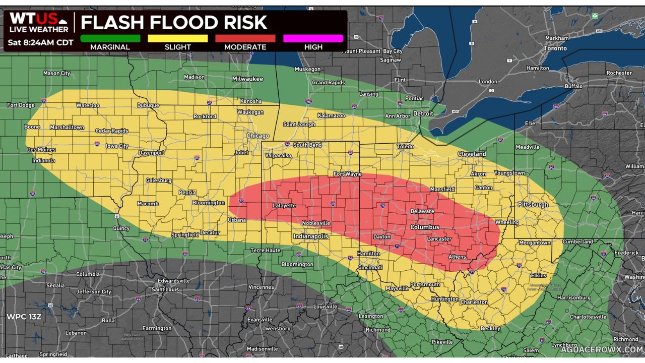
Canton’s nearly 10-inch total caps off a stretch of days that has already seen this same general region of Illinois and the surrounding Midwest hit by repeated rounds of heavy rain and flash flooding. With totals approaching 10 inches concentrated in such a narrow corridor, the Fulton-to-Vermilion County band stands out even against a broader pattern of saturated ground and ongoing flood concerns across the Ohio Valley and Midwest this week.
For more coverage like this, check back for the latest severe weather updates.