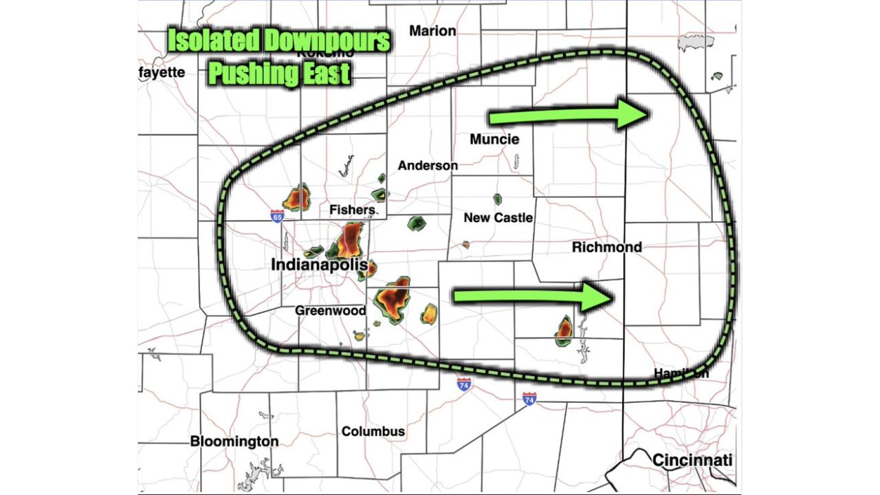
INDIANAPOLIS, Ind. — Isolated downpours formed over central Indianapolis just after 1:25 a.m. EDT early Sunday and were tracking east through the overnight hours, passing near Fishers, Greenwood, Anderson, New Castle and toward Muncie and Richmond. Forecasters warned that even modest additional totals of 0.25 to 0.5 inches could prove detrimental in areas that simply cannot absorb much more rain.
What the Overnight Radar Shows
- Formation time: 1:25 a.m. EDT, Sunday, Aug. 16, 2026
- Movement: pushing east over the coming hours
- Cities in the path: Indianapolis, Fishers, Greenwood, Anderson, New Castle, Muncie, Richmond
- Additional rainfall expected: at least 0.25 to 0.5 inches
- Key concern: areas that cannot take much more rain
- Risk: flooding conditions can be exacerbated very quickly
Why Half an Inch Is Enough to Worry About
Normally, 0.25 to 0.5 inches of rain wouldn’t register as a serious threat on its own. What changes the equation here is the ground beneath it: after repeated rounds of heavy rain across central Indiana in recent days, soil, streams, and drainage systems in the Indianapolis corridor have little to no capacity left to absorb anything new. That’s why forecasters specifically warned these isolated downpours could exacerbate flooding conditions very quickly, even though the rainfall totals involved are modest by the standards of this week’s larger storms.
What to Watch For as Downpours Track East
As of this writing, isolated downpours were actively moving east across the Indianapolis metro as of the early morning hours. No confirmed flooding, damage, or injury reports tied to this specific round have been published. This article will be updated as conditions develop or confirmed impacts are reported.
The Last Straw for an Already Saturated Region
Sunday’s overnight downpours may look minor on a rainfall map, but they’re landing on ground that has absorbed far more than its share this week, turning even small additional totals into a real flooding concern. As the isolated cells continue pushing east from Indianapolis toward Muncie and Richmond, residents across the path are being urged to take caution, since flooding here can develop faster than the rainfall amounts alone would suggest.
For more coverage like this, check back for the latest severe weather updates.