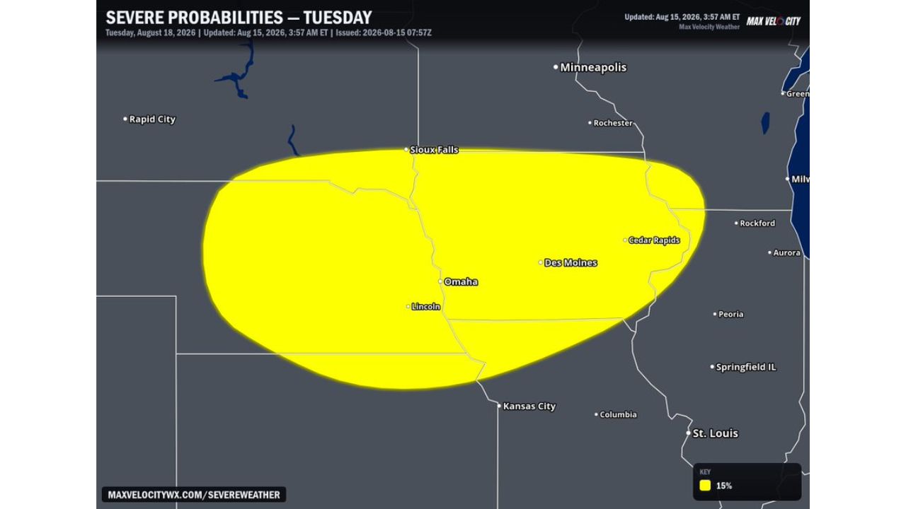
DES MOINES, Iowa — Nebraska and Iowa’s active severe weather pattern is showing no signs of slowing down, with forecasters flagging a 15 percent severe probability zone for Tuesday, Aug. 18, stretching from Sioux Falls and Omaha through Des Moines and toward Cedar Rapids. A cold front pushing into a very unstable environment is expected to spark supercells during the afternoon, with the storms then merging and tracking southeast through the evening as the threat shifts from large hail to damaging wind.
What Tuesday’s Setup Shows
- Severe probability: 15 percent
- Valid: Tuesday, Aug. 18, 2026
- Updated: 3:57 a.m. ET, Aug. 15, 2026
- Zone covers: Sioux Falls, Omaha, Lincoln, Des Moines, Cedar Rapids
- Trigger: cold front moving into a very unstable environment
- Initial storm mode: supercells developing during the afternoon
- Initial hazard: large hail
- Evening evolution: storms merge and track southeast
- Evening hazard: damaging wind threat
Why the Storm Mode Shift Matters
Tuesday’s setup follows a pattern common to strong cold-front days: individual supercells fire first, capable of large hail as their primary threat, before the atmosphere and storm dynamics push them to merge into a larger cluster later in the day. That merger typically changes the dominant hazard, shifting the danger from isolated large hail within discrete storms to a broader, faster-moving damaging wind threat as the cluster tracks southeast through the evening. For residents in the zone, that means the type of threat they face could look very different depending on whether storms reach their area in the afternoon or after dark.
What to Watch For as Tuesday Develops
As of this writing, this is a forecast outlook for Tuesday, not a confirmed watch or warning. No severe thunderstorm watches tied to this system have been issued yet. This article will be updated as watches, warnings, or storm reports are issued closer to and during the event.
An Active Pattern That Won’t Let Up
Tuesday’s setup adds another chapter to what forecasters describe as a persistently active stretch for Nebraska and Iowa, with supercells and merging storm clusters becoming a recurring feature of the region’s summer pattern. With the threat evolving from hail to wind over the course of a single day, residents from Sioux Falls to Cedar Rapids are being urged to track the setup through both the afternoon and evening rather than expecting a single, uniform threat.
For more coverage like this, check back for the latest severe weather updates.