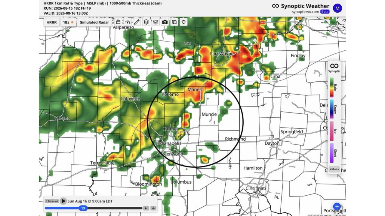
KOKOMO, Ind. — More storms are on tap for Sunday morning across a corridor including Kokomo, Marion, Muncie, Carmel and Indianapolis, with pockets of heavy rainfall threatening to worsen flooding that’s already ongoing across the region. Forecasters warned it won’t take much additional rain to exacerbate the situation, and flagged a secondary risk this time: localized wind gusts of 40 to 60 mph that could topple trees weakened by weeks of waterlogged soil.
What Sunday Morning’s Setup Shows
- Timing: Sunday morning, Aug. 16, 2026 (HRRR model valid 9:00 a.m. EDT)
- Primary threat: pockets of heavy rainfall and heavy rain rates
- Compounding factor: already ongoing flooding across the region
- Secondary threat: localized wind gusts of 40 to 60 mph
- Elevated hazard: trees with weaker footing due to very saturated soils
- Corridor affected: Lafayette, Kokomo, Marion, Muncie, Carmel, Indianapolis, Greenwood
Why Saturated Soil Turns Wind Into a Falling-Tree Hazard
A 40 to 60 mph wind gust wouldn’t normally be enough to bring down large numbers of trees on its own, but forecasters specifically called out how weeks of saturated ground change that equation. When soil stays waterlogged for an extended stretch, tree roots lose the firm anchoring they’d normally have in drier conditions, making trees far more prone to toppling even in wind events that would otherwise pass without much impact. That combination, heavy rain reinforcing already-soft ground while wind gusts test root systems that can no longer hold firm, is what elevates an otherwise modest wind threat into a real hazard for property and power lines across the corridor.
What to Watch For as Sunday Morning Storms Arrive
As of this writing, storms tied to this setup were forecast to move through Sunday morning, with flooding already an ongoing concern in the corridor. No confirmed wind damage, downed tree, or flooding reports specific to this round have been published. This article will be updated as warnings are issued or confirmed impacts are reported.
A Pattern Meteorologists Call Unbelievable
Sunday’s setup adds yet another round to what forecasters are calling an unbelievable stretch of active weather for central Indiana, where repeated heavy rain has left the ground with little capacity to absorb more water or hold trees steady against even modest wind. With Kokomo, Muncie and Indianapolis all sitting inside the highest-impact zone, residents across the region are being urged to watch for falling trees and continued flooding as this persistent pattern shows no sign of easing.
For more coverage like this, check back for the latest severe weather updates.